|
Stop off points -
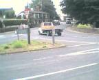
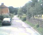
1. After parking your car somewhere safe on the
roadside
Walk down to the main road cross over and turn left heading towards
Belper.
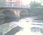
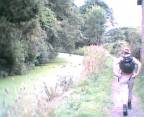
2. Just before the Bridge Turn Right and go down
the path. Keeping the river and metal railings on the left hand side.
3. Go past the sewage pumping station and into a field
Go through a squeeze Stile into the next field
4. Then through another Squeeze stile By a gate
into a third field and turn right. Walk down a track lined by large
trees. Carry on down the track Past houses and a mill until you reach
Cheving road.
Turn right on Cheving road After approx 50 metres join up with Farnah
green
turn right until you reach the A517.
Turn left here heading towards Ashbourne / Black Brook.
5. After approx 400 metres turn right to go up
LongWalls lane, the lane turns into abit of a footpath Carry on for approx
2 kilometers Ignore the first road on the left and carry on up the track
to the end where it joins up with another road on a bend. Turn left here
heading slightly down hill after 100 meters at a public footpath signpost
turn right over a stile into a field. Cross this field to a Squeeze stile
near a pilon.
6. Go through the squeeze stile and veer left up hill
to the top right hand corner Go through the Squeese style or gate
opening
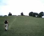
7.carry on straight up the field to another squeeze
stile at the top Go through another field and another squeeze stile,
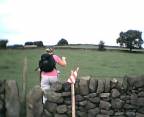
8. Another field and another Squeeze stile following
the red and white triangle signs.
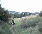
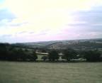
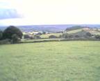
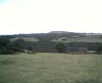
9. From here you get excellent views Cary on heading
for a waymark post and then a squeeze stile go accross this field with a
farm on the left to another squeeze stile at the end of this field. Go
through another field and another stile. In the next field go through the
fence stile in the middle and carry on to the squeeze stile in the
wall in the far right corner.
Turn right through this stile keeping the hedge on the right hand side.
10. head towards the gate at the top. go through the
gate to a wooden sign at the top joining a small road turn right
walking down the road for approx 1 kilometer. At a road junction turn
right signposted Belper and Blackbrook.
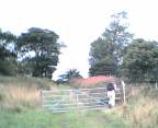
Just after a layby on the left go through a squeeze style by a gate
into a field.
follow a wall on the right heading downhill at the end go through a
stile on the left by a gate. head downhill through a gate then a stile
heading towards a farm go through the 2 metal gates to the left of the
farm and onto the road.
Go straight over this road and through a stile sign posted youth
hostel 0.5 mile and public footpath go through a wooden gate into a
woodland.
11. On reaching a carparking area keep left going up
hill follow the waymark sign heading right up hill to reach a wooden
seat by a gate. Go through the blue metal gate and carry on through the
field keeping the wall on the right hand side. at the bottom of the field
go straight on down a walled track and Over a stile by a gate
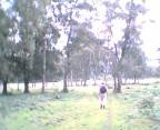
12. keep going straight ahead through trees. at the
end of the trees follow a waymark sign going left keeping a stone wall on
the left. just follow the track over a stile or through the gate if open
and then past a playing field and monument on the right. at the end of the
track go over the ladder stile by a gate joining up with a road. Turn
right going down hill past chappel lane on the left at a farm entrance on
the right turn left to go over a stile to another stile by a metal gate
into a field and then turn right walking down the field go through a gap
in the hedge and turn left. Go over a wooden stile and up the next field
with the hedge on the right hand side.
13. At the top go through a squeeze stile turning
immediately right and through another squeeze stile by a blue gate and
carry straight ahead at a junction of paths keeping a low brick wall on
the right hand side. Crich stand can be seen in the distance. just keep
going ahead through fence openings and downhill, following a line of
pilons. Head to the right of a cottage and go down a
track and through 2 stiles to join up with the cottage access road,
carry on down this road to join a road at the bottom. Turn left and then
immediately right over a stile into a small field over the next stile
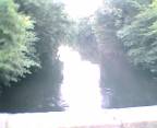
to join the A6 on a bend and by a bridge. Cross over the road and turn
right to go over the bridge.
14. Turn left past the Derwent hotel and head up
hill. just before another bridge Turn right to join the canal
path.
15. leave the towpath by a bridge where there are
signs (welcome to cromford canal), (cromford 5 miles) and
a 2 waymark arrows one purple herritage way arrow and one Green arrow
for derwent valley walk.cross the wall stile and turn right down the
single track road under a bridge to join up with the A6.
Turn left on the A6 cross over the road and walk past the hurt Arms and
cricket field.
16. Go Down Holly lane on the right, crossing the
derwent on a bend take the road on the right and then through the gap
in the fence on the left with a purple and yellow Herritage way arrow.
Walk up through Birches wood eventually joining back up with Holly lane.
17. Cross Holly lane and go down Whitwells lane for
approx 1 kilometer.
just after a wood go over the wall stile on the left signposted
belper.
keep going straight ahead and over a waymarked stile, keep a wall on
the right and go through a gate go straight ahead on a track to another
gate at the end of the track, go through the squeeze stile by the gate and
carry on down the track following the Herritage way signs
18. Keep going on this track past a nature
reserve on the left, at the end of this track you join Belper lane which
is where your car should be parked.
|